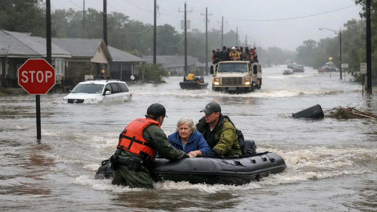
HOUSTON — Severe flooding struck parts of the U.S. Gulf Coast on Wednesday after days of heavy rainfall from a tropical disturbance that forecasters said could become the first named storm of the 2026 Atlantic hurricane season.
Torrential downpours have triggered flash flooding, urban flooding and water rescues across Texas, with impacts extending into Louisiana and threatening Mississippi, officials said. The National Hurricane Center reported that the system, designated Potential Tropical Cyclone One and later named Tropical Storm Arthur in some updates, brought life-threatening flooding risks regardless of full tropical cyclone formation.
Texas Gov. Greg Abbott issued a disaster declaration for more than 100 counties facing flooding threats, the Texas Department of Public Safety and local media reported. Heavy rain has already caused flooded roads, stalled vehicles and at least one water rescue in the Austin area earlier in the week, with additional impacts in Houston and surrounding regions.
Rainfall totals of 5 to 10 inches (about 125 to 250 mm) were forecast for portions of the mid and upper Texas coast eastward into Louisiana, Mississippi, Alabama and the Florida Panhandle through Thursday or Friday, with isolated amounts up to 20 inches possible, according to the National Hurricane Center and Weather Prediction Center.
“The main hazard with these types of systems is largely the flooding from the heavy rainfall,” National Hurricane Center Director Mike Brennan said in a statement. “And we could see potentially life-threatening flash and urban flooding across the Texas coast eastward into central Mississippi through Thursday.”
More than 40 million people across the Gulf Coast region were under flood watches, with flash flood emergencies issued in some areas, forecasters said. Gusty winds and minor coastal flooding were also possible along portions of the northwestern Gulf Coast, while isolated tornadoes could occur in parts of southern Louisiana and Mississippi.
The prolonged rainfall event has strained drainage systems in flood-prone urban areas like Houston, where warnings have been in effect since earlier in the week. Details on specific casualties or widespread structural damage remained unclear Wednesday as emergency responders continued operations.
As of late Wednesday, the system was drifting northeast toward the Texas-Louisiana border and expected to weaken after moving ashore, according to forecasts. Negotiations over response efforts and recovery were ongoing at state and local levels, with additional rain possible into the weekend.
The National Weather Service and local authorities urged residents to avoid flooded roads and stay informed through official channels.