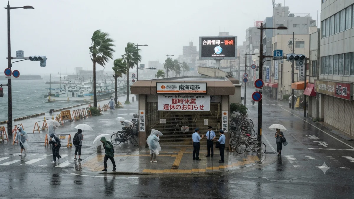


Typhoon Dolphin is disrupting transport, power supplies and economic activity across southwestern Japan while eastern China shuts ports, schools and tourist facilities ahead of the storm’s expected landfall, turning a powerful Pacific cyclone into a cross-border test of disaster preparedness and infrastructure resilience.
The storm struck Japan’s Okinawa prefecture with sustained winds of about 162 kph and gusts reaching 216 kph, according to reporting citing Japanese authorities. More than 50,000 buildings, mainly in Okinawa and Kagoshima, were without power and six people were injured. Airlines cancelled flights as authorities continued to warn of dangerous winds, heavy rain and high waves.


The disruption illustrates why the effects of a typhoon cannot be measured only by whether its centre makes landfall. Dolphin’s wind field and rainfall are affecting aviation, electricity networks and coastal transport over a wide area. In Okinawa, Naha Airport was closed on Friday and all domestic and international flights were cancelled, while hundreds of residents moved to evacuation centres. Japan had already cancelled more than 500 flights and ordered evacuations affecting nearly 260,000 people in Okinawa and Kagoshima as the storm approached.
The timing also increases the potential consequences for parts of southern Japan. Kyushu is still dealing with damage from a recent magnitude 7.1 earthquake, leaving some homes and infrastructure more vulnerable to additional rain and wind. Reuters reported that Toyota suspended operations at nine factories as the storm approached, demonstrating how precautionary closures can extend from public services into manufacturing even before significant physical damage is recorded.
China is now facing a different phase of the storm: preparing for its expected coastal landfall. Authorities raised the national emergency response to Level III and classified Dolphin as an orange-category typhoon. Forecasts called for landfall between Zhoushan in Zhejiang province and Fuding in Fujian, with eastern areas including Zhejiang and Shanghai facing heavy rain, strong winds and disruptions to transport. Some locations could receive more than 600 mm of rain, according to Reuters.
The scale of the preparations reflects the exposure of China’s densely populated eastern coast. Zhejiang authorities suspended ferries, cruises and water-based tourist activities, while tourist sites were closed. Ningbo shut schools and educational facilities for the weekend and had about 800 ships docked at its port as a precaution, according to the Associated Press. Such measures are intended to reduce casualties and prevent vessels and passengers from being exposed to rapidly deteriorating coastal conditions.
The economic implications extend beyond immediate storm damage. Zhejiang and Shanghai form one of China's most important manufacturing, logistics and trading corridors, while their ports connect domestic production with international supply chains. Flight cancellations, port closures and temporary factory shutdowns can therefore produce economic effects even when infrastructure ultimately avoids major destruction. The decision to suspend activity before landfall represents a trade-off between preventing losses and accepting short-term disruption.
Dolphin has also exposed the intersection between weather management and regional maritime tensions. China imposed traffic-control measures on shipping in the Taiwan Strait as the typhoon approached. Taiwan's authorities rejected the move as illegitimate and said its coast guard had not observed unusual Chinese activity affecting shipping communications. The immediate operational issue remains storm safety, but the episode demonstrates how extreme weather can intersect with existing disputes over maritime authority and navigation.
The storm's evolution is also significant. Dolphin intensified rapidly over unusually warm Pacific waters earlier in its life cycle, reaching extreme intensity before weakening as it moved toward the Ryukyu Islands and China. Earlier reporting noted sea-surface temperatures of about 30°C during its rapid strengthening. The weakening does not eliminate the threat: rainfall, storm surge and the geographical size of damaging winds can remain significant even as maximum sustained winds decline.
For now, the confirmed picture is one of progressive disruption from Japan toward China's eastern seaboard. Japan is dealing with the storm's immediate aftermath, including power outages and injuries, while China is concentrating on evacuation, port, school and transport measures before landfall. Authorities are continuing to monitor Dolphin's track, rainfall, winds, flooding and coastal conditions, with the precise location and severity of its Chinese landfall remaining the key near-term uncertainties.