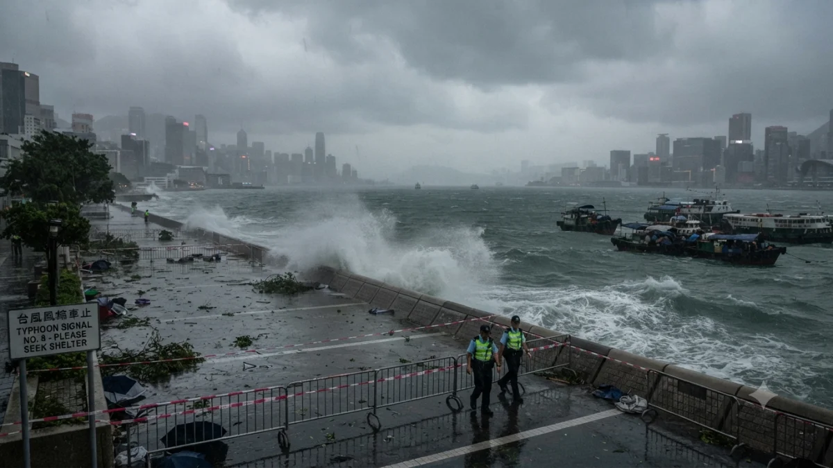


Typhoon Dolphin was disrupting transport, power and maritime activity across a wide stretch of East Asia on Sunday as the storm approached landfall on China’s eastern coast, after already affecting Japan and Taiwan. The storm’s significance lies not only in its wind strength but in the scale of precautionary disruption required across densely populated coastal and transport hubs before the system reaches land.
Dolphin was forecast to make landfall between Zhejiang and Fujian provinces overnight Sunday into Monday, carrying winds of up to about 162 kph and bringing the prospect of very heavy rainfall. Chinese authorities warned that parts of Zhejiang could receive roughly 250 to 500 millimetres of rain, increasing risks of flooding, landslides and dangerous river levels even if the typhoon weakens after moving inland.


That threat has prompted an unusually broad shutdown of infrastructure. Shanghai canceled more than 1,300 flights at its two major airports, while authorities suspended ferries and cruises and imposed restrictions on other transport. About 60% of flights at Shanghai's Hongqiao and Pudong airports were canceled, according to reporting by The Associated Press. More than 390,000 people were evacuated in Taizhou, while more than 30,000 people in Shanghai were moved from areas considered vulnerable.
The measures illustrate an important feature of typhoon risk in East Asia: disruption can begin well before the strongest winds reach a city. Shanghai is a major aviation, shipping and manufacturing center, while the Yangtze River Delta contains dense networks of ports, railways, factories and logistics facilities. Authorities therefore face a trade-off between keeping economic activity operating and reducing exposure to wind, flooding and storm surge. The decision to cancel flights and relocate vessels represents a preventive strategy rather than evidence that those facilities have already suffered major damage.
Maritime activity has been particularly affected. Shanghai's Yangshan port moved more than 500 vessels to safer locations, while Chinese authorities recalled fishing boats and suspended ferry services. Such measures can temporarily interrupt cargo movements and supply chains even when physical damage ultimately proves limited. The scale of the response also reflects the difficulty of assessing coastal hazards from wind speed alone, because storm surge, waves and rainfall can create separate risks across different locations.
Japan experienced the first major effects as Dolphin passed through the country's southern islands. Six people were injured and power was disrupted to more than 50,000 buildings across Okinawa and Kagoshima prefectures, Reuters reported. Airlines including ANA and Japan Airlines canceled flights, while Naha Airport was closed during the storm's passage. The Japanese disruption demonstrates how a weakening or changing tropical cyclone can remain operationally significant after its peak intensity has passed.
Taiwan was also affected, particularly by heavy rainfall and aviation disruption. Reuters reported that 78 flights, mostly international, were canceled. At the same time, the storm intersected with an existing political sensitivity: China issued navigation restrictions in the Taiwan Strait as Dolphin approached. Taiwan's authorities rejected those directives, while its coast guard said it had not observed unusual Chinese interference with shipping communications. The episode shows how a natural hazard can complicate already sensitive maritime activity without itself changing the underlying political dispute.
The principal concern for China now shifts from wind damage to rainfall and flooding. Authorities have activated emergency responses in Zhejiang and Fujian and lower-level measures in Jiangsu and Anhui, while geological-disaster warnings have been issued in vulnerable areas. Forecasts that Dolphin could weaken but linger over central and southwestern China are significant because slower movement can extend rainfall over the same drainage basins. Officials are consequently monitoring rivers including the Qiantang and Yong and urging residents in areas facing severe mountain-torrent risks to evacuate.
The storm's evolution also underscores why intensity alone is an incomplete measure of typhoon risk. Dolphin strengthened dramatically over the western Pacific before weakening as it approached East Asia, but its effects have remained geographically extensive. Earlier U.S. National Weather Service advisories documented rapid intensification, including an upgrade from tropical storm to typhoon as Dolphin moved westward in late July.
As of Sunday, the confirmed picture is therefore one of extensive preventive disruption rather than a completed damage assessment in mainland China. Okinawa has already reported injuries and widespread power interruptions, while China is still preparing for landfall and its potentially more consequential rainfall phase. Authorities are continuing to monitor the storm's track, wind strength, rainfall totals, river levels, landslide risk and coastal conditions; the extent of flooding, infrastructure damage and economic disruption will depend on Dolphin's final landfall location and its movement after entering China.